Efficiency and Speed in Today’s Renewable Energy Landscape
Key Insights Federal policy shifts are reducing or eliminating clean-energy incentives, creating immediate pressure for...
Calculate, schedule, and track landowner payments with precision — from option agreements through full operations — without relying on spreadsheets.
Streamlines complex payment approval workflows to minimize risk and boost efficiency, even at high volumes.
Automates intricate calculations based on acreage, installed capacity, production output, or revenue.
Handles escalations seamlessly, including fixed, step-ups, and CPI-based increases.
Eliminates spreadsheet errors, enforces financial controls, and enables lean teams to scale without adding headcount.

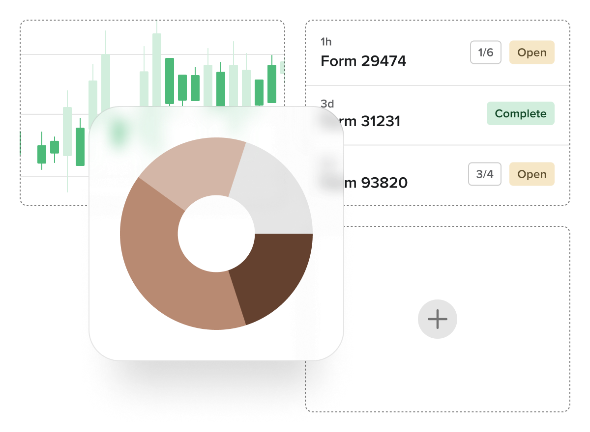
Gain powerful, real-time insights through robust reporting capabilities, seamlessly integrated with Power BI for customizable dashboards and advanced analytics.
Live data reporting — no delays, no stale exports — just always-current information.
Access a library of 50+ pre-built reports covering common land, agreement, and payment scenarios.
Build custom dashboards with Power BI and control user access with configurable permissions.
Enable role-based permissions and automate report delivery on your schedule.
Easily generate bulk documentation like landowner letters and payment statements to streamline communication.
Built-in KPI reports for measuring project, process, or personnel performance.

A powerful, Esri-based interface that brings spatial awareness to land, asset, and agreement data, designed to integrate seamlessly into your existing GIS ecosystem.
Connects with enterprise GIS systems for two-way data sharing — no duplication, no silos, no disconnects.
Supports standard geospatial formats, including KML, KMZ, and Shapefiles, for easy data exchange with external partners.
Enables both map-based and list-based data entry, accommodating disparate user preferences.
Role- or department-based map views ensure users see only relevant, real-time information.
Available as a fully embedded solution or a complement to your current GIS, adapting to your organizational needs.


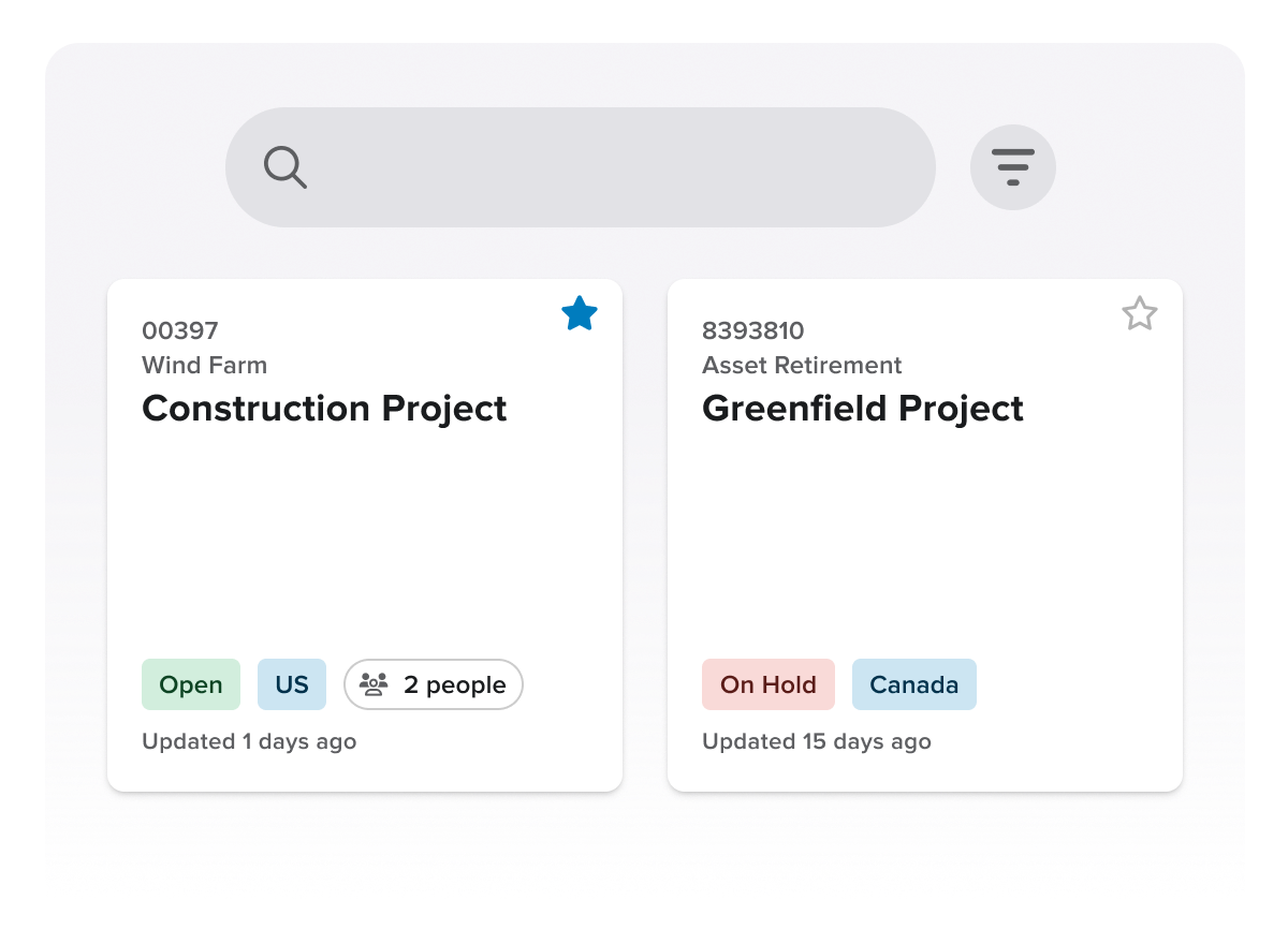
A centralized platform designed to coordinate and streamline land acquisition and ROW activities across departments, contractors, and project phases.
Maintains data continuity across the full project lifecycle — from site identification and title research to permitting, surveying, and beyond.
Tracks legal obligations and landowner-specific commitments to ensure ongoing compliance and improved stakeholder engagement.
Acts as a centralized, standardized data repository, enhancing collaboration and preserving institutional knowledge across project teams.
Supports controlled access for external contractors and provides services to import legacy agreements and historical land data.

Proactively manage lease and agreement lifecycles with automated workflows, real-time alerts, and a fully integrated system that ensures compliance and eliminates manual tracking.
Configurable alerts for key milestones, such as expirations, renewals, payments due, and option deadlines, keep teams ahead of critical dates.
Simplify landowner splits and ownership changes with built-in tools that reduce manual errors and legal risk.
Automate complex payment schedules and escalations while using forecasting tools to anticipate future cash flow needs.
Track non-financial obligations (e.g., insurance, performance reporting) to ensure complete compliance with all agreement terms.
Replace spreadsheets with a centralized, time-stamped record system that improves data accuracy, audit controls, and team collaboration.

Manage all details of your telecom project, from land rights to tower leases, with Irth Land.
Our detached platform lets your field workers access your company’s database anywhere, even in remote locations without Internet connections.
Automated compliance reports ensure you save time and never miss a deadline.
Track subleases and lease details, payments, inspections, maintenance, and more in our comprehensive platform.
Irth Land provides a consolidated view of parcels, energy data, and ticket information.

Accelerate land access and keep projects on track with a secure, intelligent platform that connects land data, agreements, and stakeholder engagement from early planning through long-term operations.
Centralize all land agreements, contracts, and communications in one system, making every record searchable and accessible.
Connect agreements directly to geographic data and project assets, with map-based views that provide clear insight into obligations, ownership, and potential conflicts.
Streamline negotiations and approvals by tracking every step of the process with repeatable workflows, assigning responsibilities, and maintaining continuity from siting through operations.
Integrate seamlessly with ArcGIS and other third-party systems to keep data aligned, up to date, and actionable, without any disruption to workflows.
Track payments, compensation, and commitments in real time, with automated reminders and audit-ready reporting that supports transparency and accountability.
Ensure compliance and build trust with a complete, traceable history of agreements, negotiations, and landholder interactions, supported by clear, location-specific reporting.
Connect stakeholder engagement directly to land agreements, making it easy to see how negotiations evolved and what was promised.

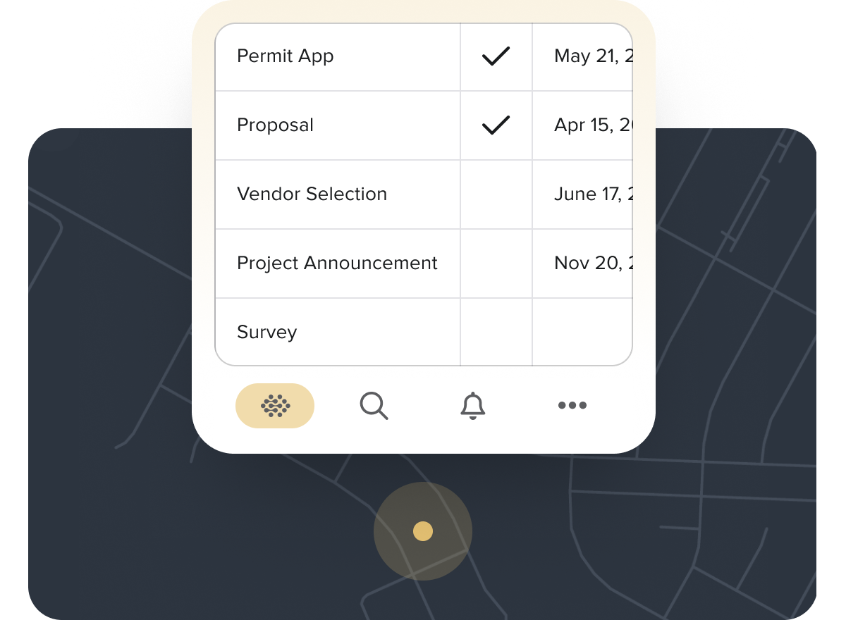
Streamline siting and permitting with a platform that connects land, stakeholder, and approval workflows, giving all stakeholders the visibility and documentation needed to move projects forward with fewer delays and less risk.
Track every permit, parcel, task, and dependency in a single workflow, so teams can quickly see what is approved, pending, or at risk.
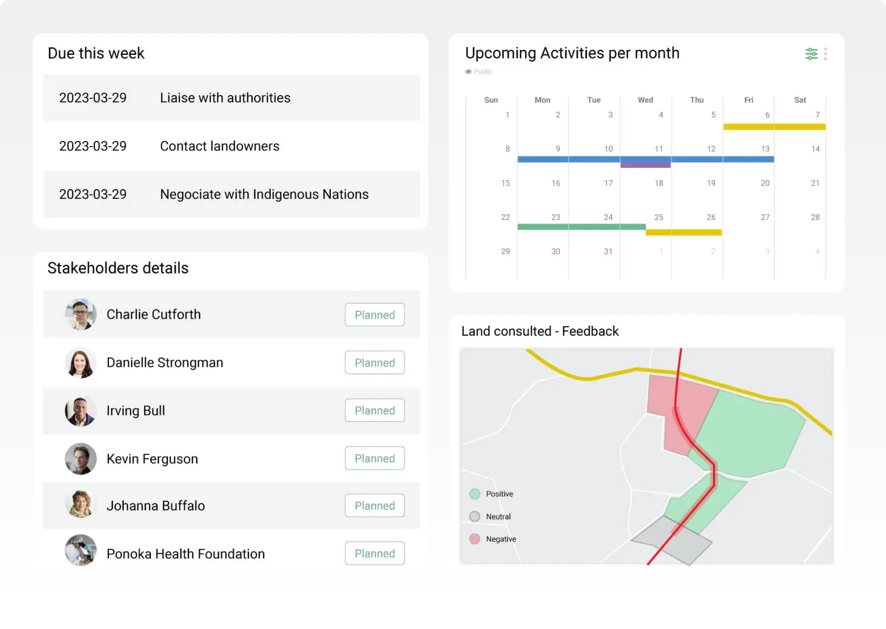
Manage stakeholder engagement with a complete record of outreach, commitments, concerns, and follow-ups across landowners, agencies, and community members.
Improve collaboration across land, legal, engineering, regulatory, and project teams with shared visibility into project status, responsibilities, and next steps.
Support multi-jurisdictional permitting by organizing various requirements, timelines, and approvals in one place.
Reduce delays by identifying bottlenecks early and keeping approvals, documents, and handoffs moving on schedule.
Maintain a defensible audit trail with centralized records that make it easy to demonstrate compliance and accountability.
Identify and engage the right government officials in real time by understanding jurisdiction, tracking positions on your project, and ensuring the right stakeholders are involved at every stage of the permitting process.
Build stronger, more resilient landowner relationships with a platform that brings clarity, consistency, and accountability to every interaction, helping you earn trust while protecting project timelines.
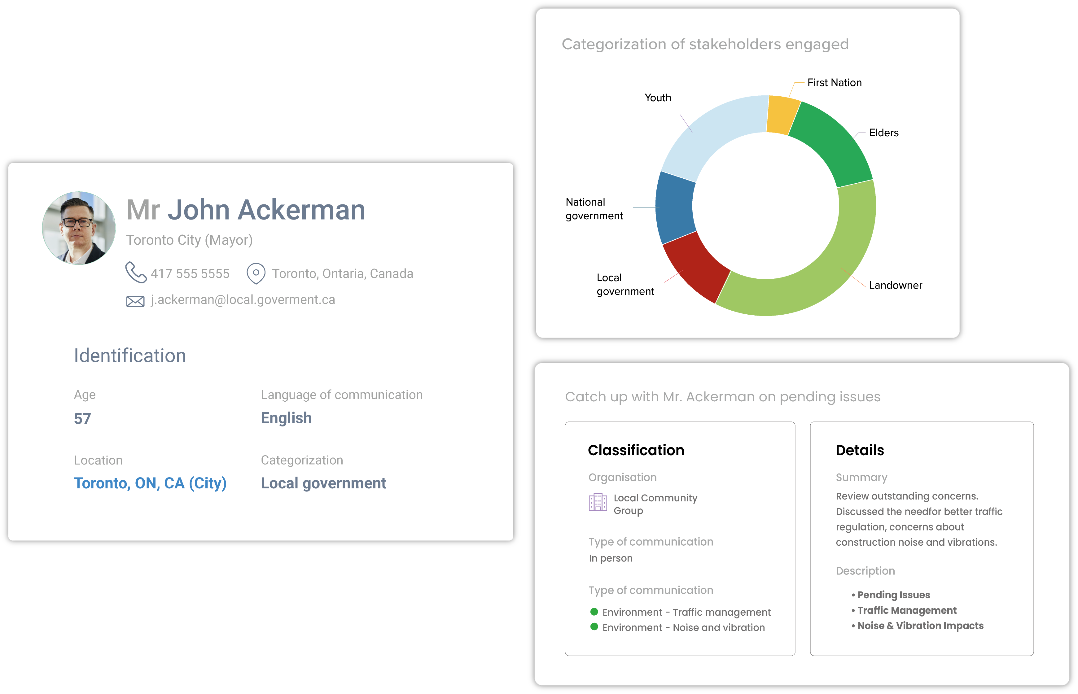
Create a single source of truth for each stakeholder, combining agreements, communications, raised issues, and commitments into a complete relationship record.
Capture and track in a single system every conversation, concern, and commitment over time, so teams always understand the full context behind each agreement.
Monitor stakeholders’ sentiment, interests, and influence to proactively manage risk, address concerns early, and support more productive, balanced outcomes.
Ensure commitments are met by tracking obligations, deadlines, and follow-ups, helping teams stay organized, avoid missed timeframes, and reinforce credibility.
Strengthen long-term relationships and your social license to operate with a clear, defensible record of fair, responsible, and responsive engagement.
Be fully prepared for every interaction with government officials by having complete visibility into past conversations, project activity in their jurisdiction, and internal engagement history across your teams.
Proactively manage stakeholder risk by identifying, mapping, and prioritizing stakeholders based on their level of interest and influence — then continuously engaging them throughout the project lifecycle to build trust, address concerns, and increase the likelihood of project success.
Learn how Trans Mountain streamlined stakeholder engagement with Irth for Stakeholder and Land Management, cutting outreach time 70% and reporting time up to 80%.